

4.6
Owner's of the Garmin GPS Receiver GPSMAP gave it a score of 4.6 out of 5. Here's how the scores stacked up:

GPSMAP 78 Series Owner’s Manual 17
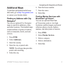
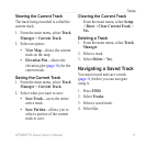
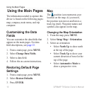
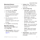
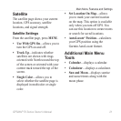
Using the Main Pages
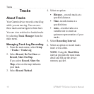
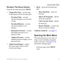
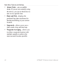
Elevation Plot Setup Options
From the elevation plot, press MENU.
Change Plot Type—sets the type
of data shown on the elevation plot:
Elevation/Time—records
elevation changes over a period
of time.
Elevation/Distance—records
elevation changes over a
distance.
Barometric Pressure—records
barometric pressure over a
period of time.
Ambient Pressure—records
ambient pressure changes over a
period of time.
Adjust Zoom Ranges—adjusts
the zoom ranges shown on the
elevation plot page.
•
◦
◦
◦
◦
•
Reset—resets the elevation plot
data:
Reset Trip Data—resets all
trip data.
Delete All Waypoints—deletes
all saved waypoints.
Clear Current Track—deletes
the track log.
Restore Defaults—restores the
device to factory settings.
Calibrate Altimeter—see page 16.
Opening the Main Menu
The main menu gives you access to
setup screens including waypoints,
tracks, and routes. See page 19 for
main menu settings pages.
From any page, press MENU
twice.
•
◦
◦
◦
◦


Find Your Products By Category
- Lawn and Garden
- Computer Equipment
- TV and Video
- Laundry Appliance
- Kitchen Appliance
- Car Audio and Video
- Automotive
- Photography
- Fitness & Sports
- Personal Care
- Communications
- Home Audio
- Portable Media
- Musical Instruments & Equipment
- Baby
- Household Appliance
- Cell Phone
- Marine Equipment
- Outdoor Cooking
- Power Tools
- Video Game
Please Login
